Azores Archipelago#
Q 63 - How to deal with knowledge gaps on socio-economic data, including the spatial dimension?
Q 25 - How to integrate the process of MPA designation or extension in MSP?
Q 26 - How to take OECM into consideration in MSP where no legal instruments are in place?
Q 29 - How to assess stakeholders’ satisfaction in a MSP/MPA process?
Q 30 - How to demostrate the effectiveness of conservation measures to stakeholders?
Q 9 - How to effectively manage conservation areas including both terrestrial and marine zones?
Q 42 - What monitoring approach can be taken for extensive MPA networks, expecially offshore ones?
Description#
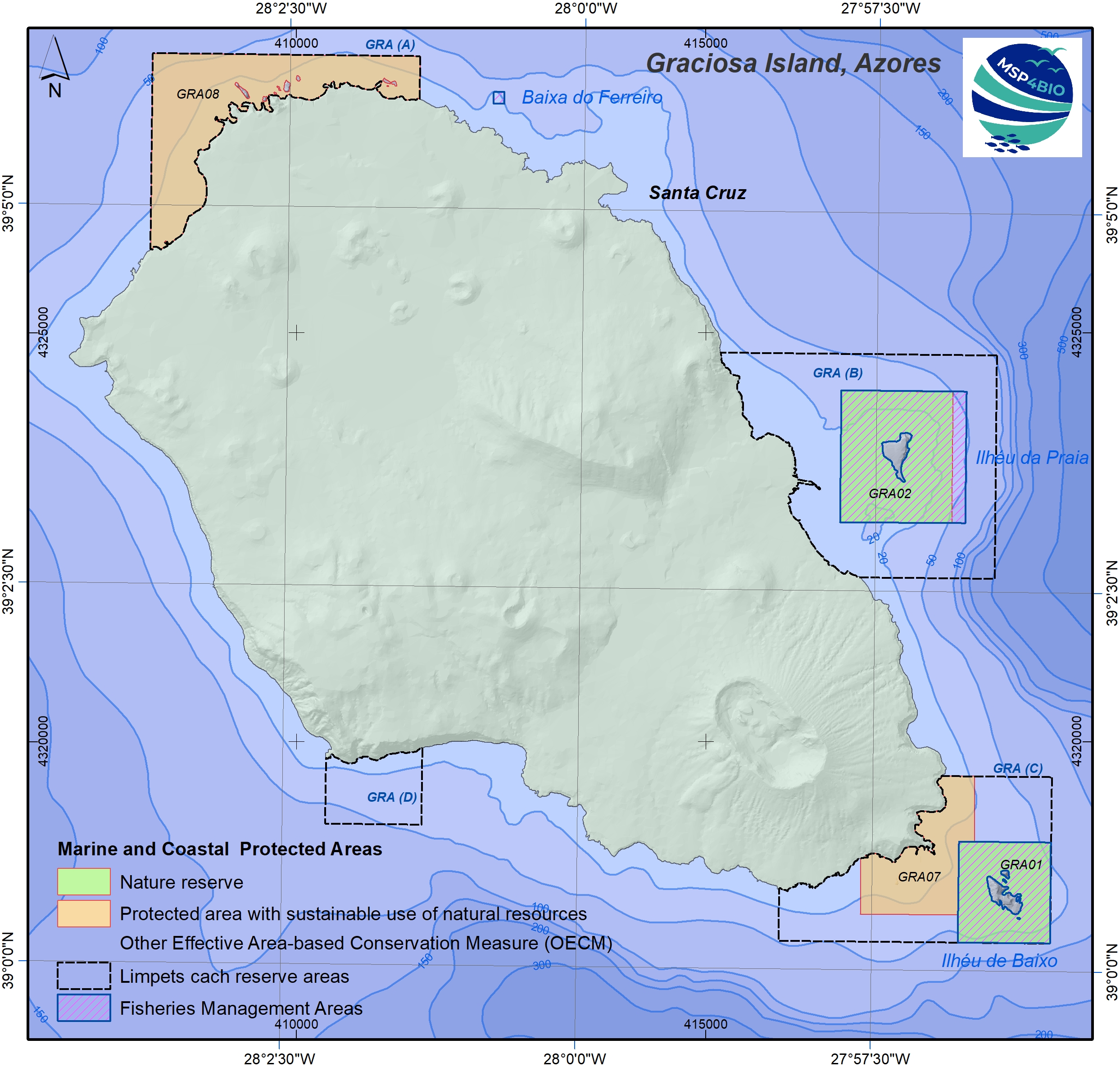
The Azores is an autonomous region of Portugal located in the north Atlantic and composed of nine islands and a rich diversity of habitats. Graciosa Island (Portuguese: Ilha Graciosa), also referred to as the White Island, is a volcanic Atlantic Island in the Azores archipelago located around 1630km from the Portugal mainland. The island has an area of 60.65 km2, a length of 10 km and a width of 7 km. Its landscape is dominated by a 1.6-km-wide central caldera (the Caldeira) located in the southeast. Population is above 4 thousand inhabitants. Coastal waters surrounding the island cover 971,582 km2 (EEZ and extended continental shelf). The most important blue economy sectors are fisheries and tourism. The key characteristics of the test site are the following: Rich habitat diversity – knowledge gaps in offshore and coastal areas; Need for strategies to enlarge MPA network in coastal areas and for “fully protected areas”; No Regional MSP approved so far (MSP plan is under public consultation).
View the Graciosa Island (Azores) StoryMap
Sources
Matczak et al. (2024) Test Sites Methodology Including the Participation Strategy (Deliverable – D5.2., under the WP5 of MSP4BIO project (GA n° 101060707))